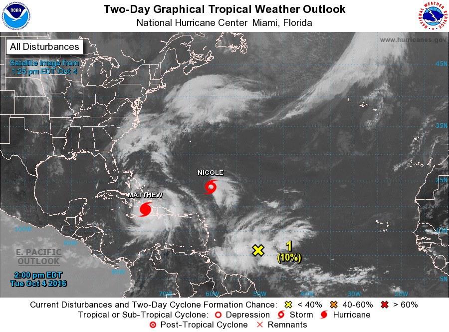
 A westward moving tropical wave located east of the island chain is expected to affect the islands tomorrow into Thursday producing an increase in shower activity. According to the National Hurricane Center. the tropical wave extends from 15North — 46West to 8North — 52West. The system is moving west- Northwest at near 15 kt over the past 24 hours. The Wave is moving through an area between two upper ridges enhancing scattered moderate to strong convection within 180 nm south-east of the wave axis. within 270 nm north-west of the wave axis south of 15North. and within 60/75 nm of a line from 16North — 38West to 2North — 45West. The National Emergency management Organisation (NEMO) here in SVG said that this afternoon (4th October) forecast: Synopsis: The leading edge of a tropical wave is approaching the islands. Forecast: Fair at first becoming increasing cloudy with some scattered showers towards the evening. A westward moving tropical wave located east of the island chain is expected to affect the islands tomorrow into Thursday producing an increase in shower activity. Residents and motorists are advised to be vigilant during the passage of this system.  |
JSR CommunicationsWe offer the best, yet most affordable business; Individual support and publishing services. Archives
August 2021
Categories
All


|
 RSS Feed
